Super Interactive Maps for WordPress empowers you to create visually compelling and highly engaging maps directly within your WordPress website. Leveraging the Google Geochart API, this plugin provides an intuitive way to display country, continent, and regional data, transforming static information into dynamic, interactive experiences. Whether you're highlighting locations of interest, showcasing geographical data, or simply adding a unique visual element to your site, this plugin offers unparalleled flexibility and ease of use.
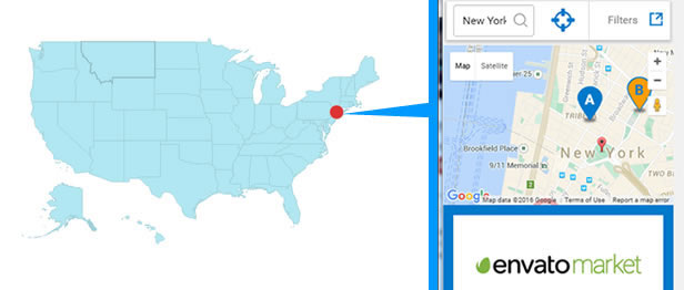
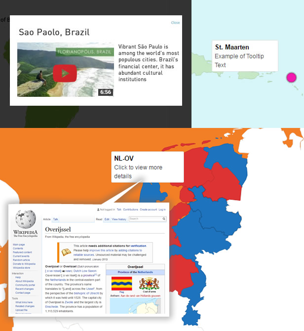
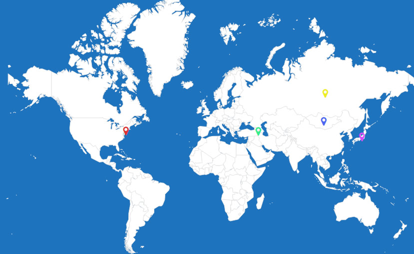
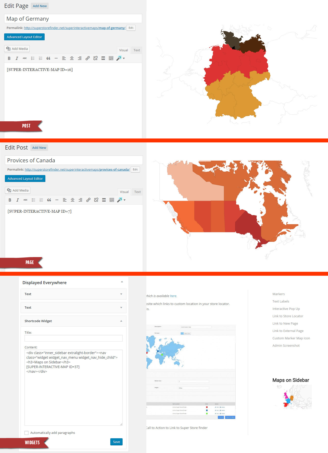
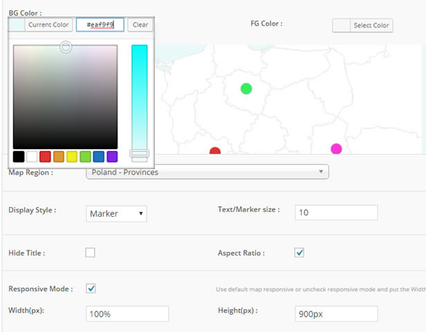
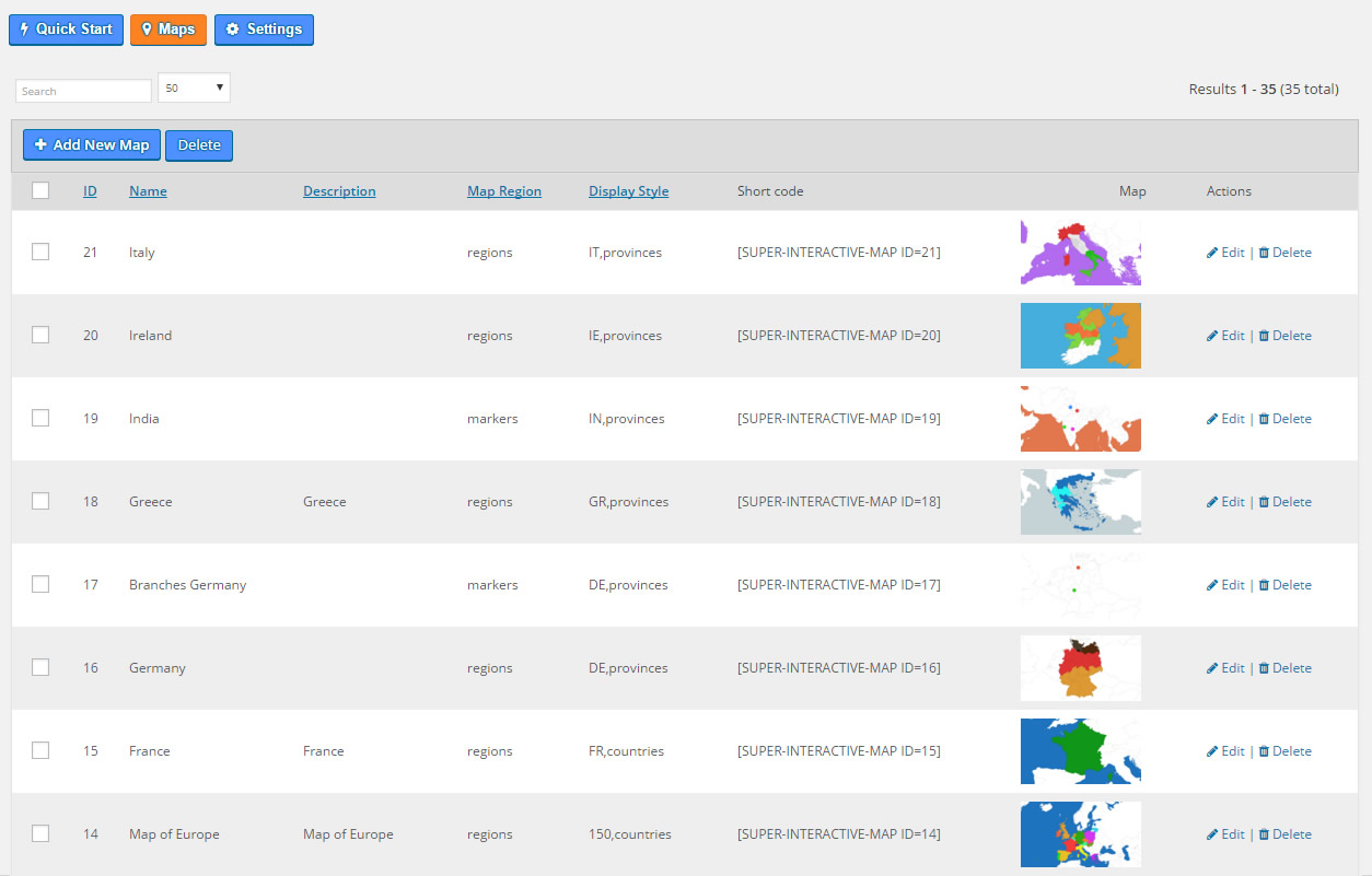
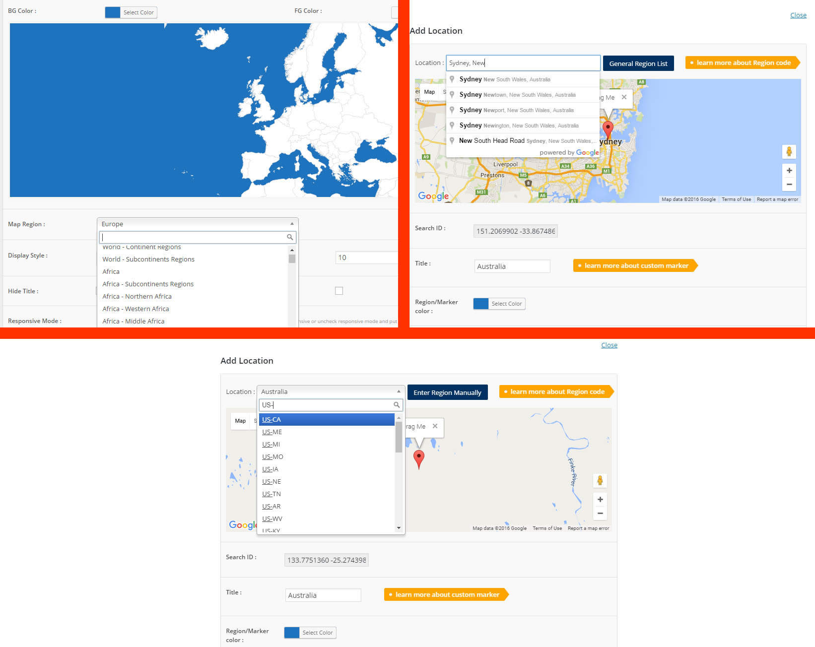
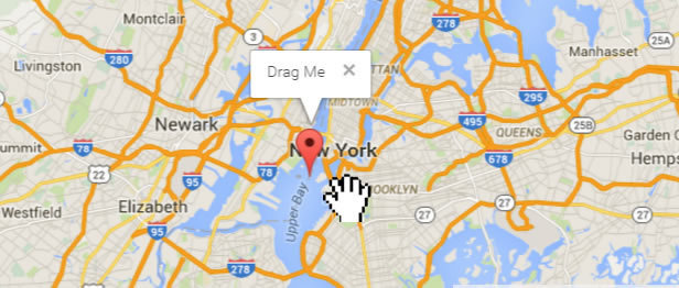
Imagine effortlessly creating custom markers to pinpoint hotels, cafes, airports, or any other relevant locations. Enhance user interaction with interactive tooltips, lightbox windows, or direct links to external web pages. The plugin’s extensive library includes over 500 pre-built maps, covering all 195 countries worldwide, and offers detailed provincial listings for comprehensive geographical representation. You can easily generate both SVG and vector maps, ensuring crisp visuals and optimal performance.
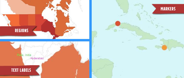
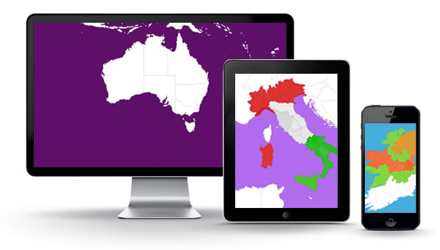
Designed for responsiveness, Super Interactive Maps delivers a flawless experience across all devices and browsers. Create captivating vector maps of the world, continents (Africa, Europe, Asia, Oceania, South America, and the Americas), and specific regions like India, China, Turkey, and many more. This plugin is the perfect solution for businesses, travel bloggers, educational institutions, and anyone looking to visually communicate location-based information in a dynamic and engaging way.
With its user-friendly interface and powerful features, Super Interactive Maps for WordPress simplifies the process of creating stunning, interactive maps, allowing you to focus on delivering valuable content to your audience.
WordPress
Google Geochart API
PHP
SVG
Vector Graphics
- Over 500 pre-built maps included
- Coverage of all 195 countries worldwide
- Detailed provincial listings
- Creation of SVG and vector maps
- Fully responsive design for all devices
- Customizable markers with interactive tooltips and lightbox windows
- Linking to external web pages
- Vector maps of continents and specific regions (e.g., Africa, Europe, Asia, India, China, Turkey)
- Cross-device and browser compatibility
WP Plugins
Super Interactive Maps for Wordpress
Bring your WordPress site to life with stunning, interactive maps! Showcase locations, engage visitors, and enhance your content with customizable markers, tooltips, and seamless responsiveness across all devices.
Who is this for?
Businesses, travel bloggers, educational institutions, real estate agents, and anyone needing to visually represent location-based data on a WordPress website. Ideal for those seeking to enhance user engagement and provide interactive geographical information.
Product Info
- Released September 28, 2025
- Version v2.4
- Developer Umva Team